Drone Inspection Image Processing & Geospatial Correlation Tool
Overview
Desktop application developed for a drone inspection company that performs infrastructure inspections of electrical utility poles.
The goal of the system was to automate the process of matching thousands of geo-tagged drone images with pole identifiers provided by utility companies in KMZ/KML (Google Earth) files.
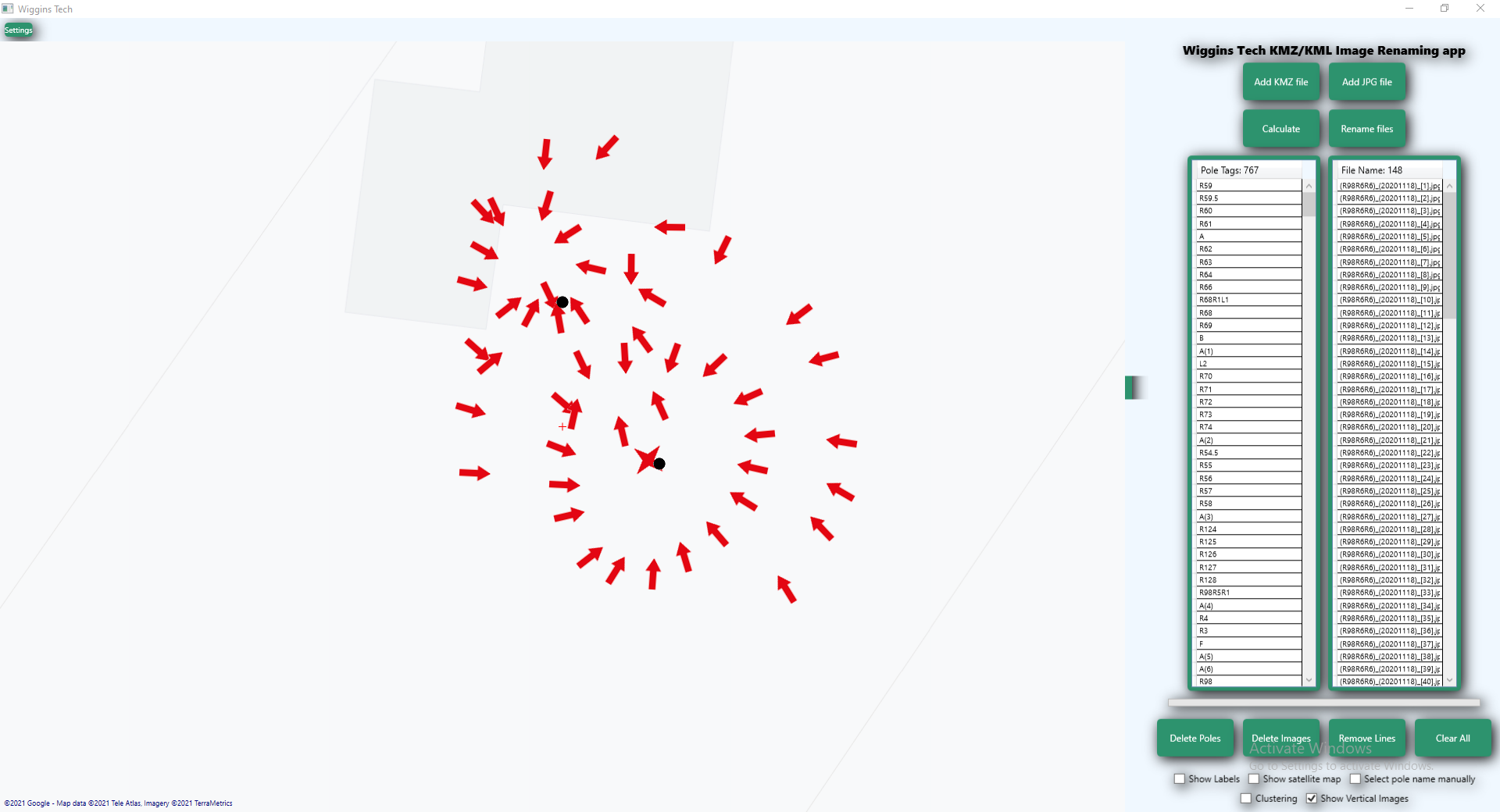
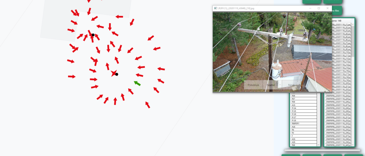
Manual processing of these datasets was extremely time-consuming and error-prone. The application provides visual tools to automatically correlate inspection images with pole locations and allows operators to review and correct associations before batch renaming the images.
Key Features
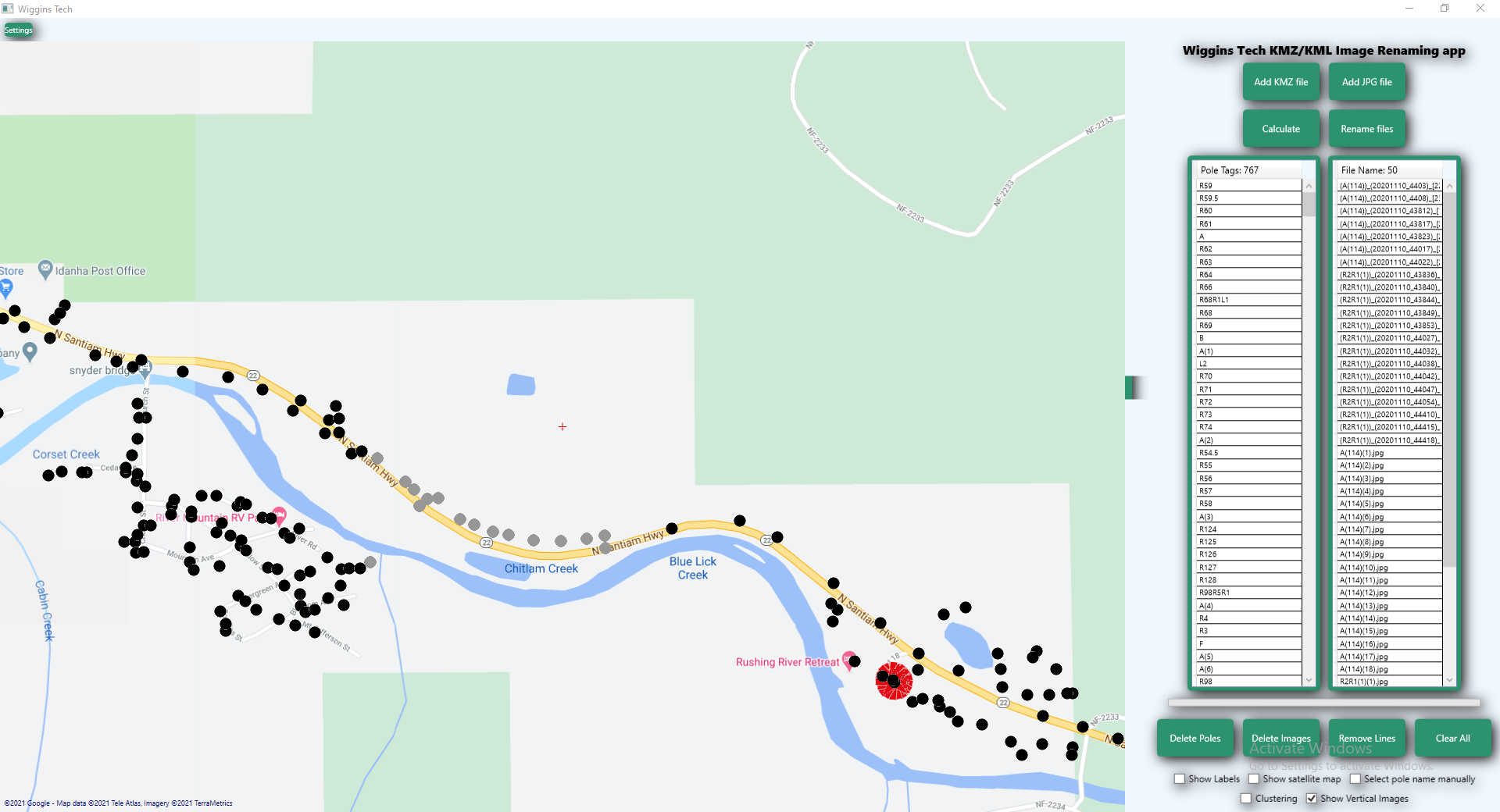
• Import and visualize KMZ/KML pole datasets from utility companies
• Load large batches of geo-tagged drone images
• Automatic matching between images and pole locations based on geospatial coordinates
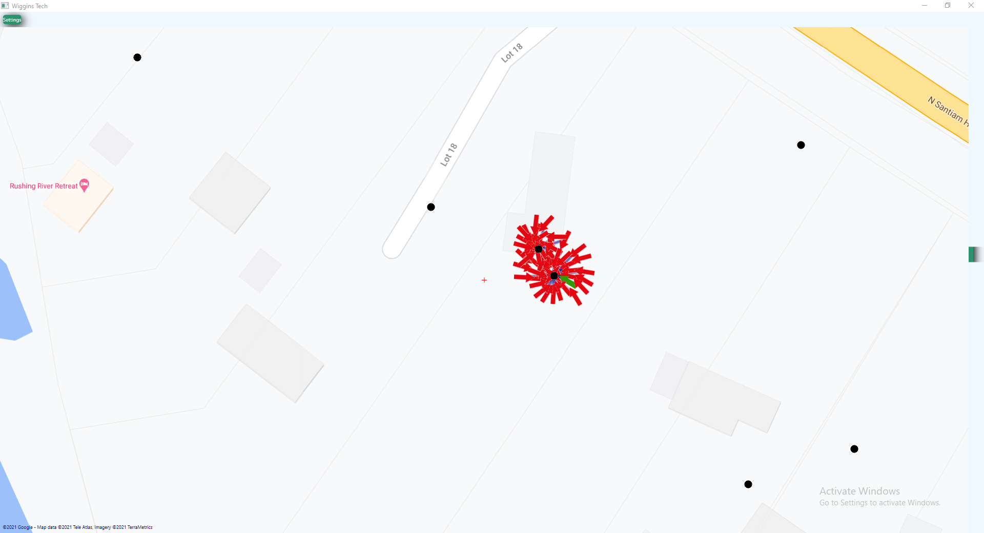
• Interactive map-based visualization using Google Maps
• Graphical display of relationships between poles and images using directional lines
• Clustering and visual grouping of inspection images
• Manual correction tools to fix inaccurate correlations
• Quality-control interface for inspection operators
• Automated batch renaming of thousands of images using pole identifiers
• Satellite and map visualization modes
Technical Highlights
• Desktop application built with C# and WPF
• Geospatial data processing using KML/KMZ formats
• Visualization of inspection datasets with thousands of points
• Automated correlation of drone imagery with infrastructure assets
• Interactive map overlays and clustering algorithms
• High-performance UI designed for large inspection datasets
Result
The software significantly reduced the time required to process drone inspection data and improved accuracy when associating inspection images with utility pole identifiers.
The solution enabled inspection teams to process large field datasets quickly and perform visual quality control before exporting the final renamed image sets.